Today's Song via YouTube Music
Canadian Prairie Storms Pages
Tuesday, August 29, 2023
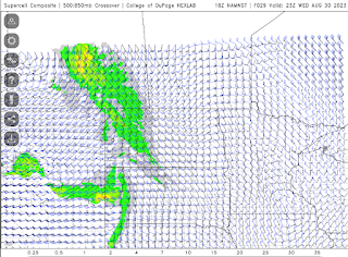
Moderate Risk #skstorm Supercells on Wednesday
Potential 220 km/hr Landfall for Hurricane Idalia
Check out the potential maximum wind gust via the NAM Nest for #Hurricane #Idalia from 119 knots at land fall, 80 knots well inland through Tallahassee, Florida. #FLwx
— ⚡️StormRangerBike🤠🚲 (@StormRangerBike) August 29, 2023
119 knots=220km/hr=137mph
80 knots=148km/hr=92mph
Lots of potential to damage structures at those rates. pic.twitter.com/YRuy4n6zVG
Monday, August 28, 2023
Strong Thunderstorm / Weak Tornado Wednesday
Today's Song: Bad Moon Rising
Check TimeAndDate.com for moon phases and SpaceWeather.com for Solar Flares
Its Happening!
Extreme humidity mixing with smoke and drought this morning as of
— ⚡️StormRangerBike🤠🚲 (@StormRangerBike) August 28, 2023
7am 94% humidity and 10C?! at the airport.
7:40am: 71% downtown and 17C feels way hotter than that. #yqrWeather #skstorm on Windy Wednesday for sure... pic.twitter.com/mYD1czsJKA
Sunday, August 27, 2023
Long Term GFS Says: Supercell Season continues... #skstorm
Looking at the potential for supercell thunderstorms in the long term GFS forecast model late into August now, in fact Wednesday to Thursday, August 30th and 31st could be a tiny spot of potential in southeast Saskatchewan and into Manitoba. Further down the charts, September 9th continues to pop up as the next "big one". Keeping an eye on that date as well as incoming CME's from spaceweather.com


