 |
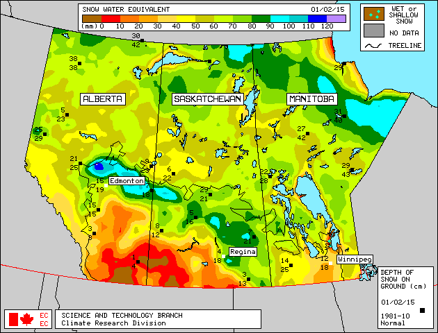
| Map from Environment Canada |
This means, the heat will be on early in the south west and without any significant rain or snow, it will be a very dry start to spring with more chance of dust storms this year. Hopefully, the drought does not spread to the rest of the farm belt. With very much normal snow packs along the Yellowhead, thunderstorms may have a difficult time getting too strong and tornadoes may be non-existent this summer in western Canada. All of this can change rapidly of course as spring showers often bring May flowers!
Here is a look at the current North American Snow Cover Map courtesy of NOAA:
These maps and more information can be found at Canadian Cryospheric Information Network
Also of note, the spring migration is just getting under way and you can see the progress of our natural seeders and fertilizers fly closer to your area via the Ducks Unlimited website.
Stay tuned to this blog for more updates on stormy weather this year!

No comments:
Post a Comment