Today's Song via YouTube Music
Canadian Prairie Storms Pages
Thursday, August 31, 2023
August 30th Timelapse of Incoming Storm Clouds / Clearing out the smoke #skstorm
Calgary Skyline Lightning This Morning via Kyle Brittain on X
Who is all awake in Calgary now? #yyc #abstorm pic.twitter.com/PxNeVyCPSe
— Kyle Brittain (@BadWeatherKyle) August 31, 2023
Wednesday, August 30, 2023
Tuesday, August 29, 2023
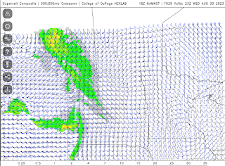
Moderate Risk #skstorm Supercells on Wednesday
Potential 220 km/hr Landfall for Hurricane Idalia
Check out the potential maximum wind gust via the NAM Nest for #Hurricane #Idalia from 119 knots at land fall, 80 knots well inland through Tallahassee, Florida. #FLwx
— ⚡️StormRangerBike🤠🚲 (@StormRangerBike) August 29, 2023
119 knots=220km/hr=137mph
80 knots=148km/hr=92mph
Lots of potential to damage structures at those rates. pic.twitter.com/YRuy4n6zVG
Monday, August 28, 2023
Strong Thunderstorm / Weak Tornado Wednesday
Today's Song: Bad Moon Rising
Check TimeAndDate.com for moon phases and SpaceWeather.com for Solar Flares
Its Happening!
Extreme humidity mixing with smoke and drought this morning as of
— ⚡️StormRangerBike🤠🚲 (@StormRangerBike) August 28, 2023
7am 94% humidity and 10C?! at the airport.
7:40am: 71% downtown and 17C feels way hotter than that. #yqrWeather #skstorm on Windy Wednesday for sure... pic.twitter.com/mYD1czsJKA
Sunday, August 27, 2023
Long Term GFS Says: Supercell Season continues... #skstorm
Looking at the potential for supercell thunderstorms in the long term GFS forecast model late into August now, in fact Wednesday to Thursday, August 30th and 31st could be a tiny spot of potential in southeast Saskatchewan and into Manitoba. Further down the charts, September 9th continues to pop up as the next "big one". Keeping an eye on that date as well as incoming CME's from spaceweather.com
Tuesday, August 22, 2023
HOLD ON #SKSTORM Next Lightning Opportunity?: Midnight Wednesday, Cooler Today.. or read below for instant update
Sunday, August 20, 2023
Kelowna Fires / Hurricane Hillary / Tropical Storm Trudeau / Supercell Wednesday
Thursday, August 17, 2023
The Next Big System
Thursday, August 17th, 2023
Today's Thunderstorm Outlook from ECCC, showing a large risk area from the foothills through Edmonton to Lloydminster, Alberta. |
Extreme heat is expected to push east into Saskatchewan and Manitoba on Friday. Depending on the timing, the short term forecast showing Regina hitting 97F/35C at 2pm while the high resolution mid-term forecast saying Brandon, Manitoba will get the big time heat wave.
Either way, there is a big system coming over the mountains which will affect everyone on the Canadian Prairies over the next few days. Expect a lot of wind, heat waves and storms to follow through the weekend until Sunday as it exits Manitoba. Good thing is, the rain should help knock down a few fires however with record ocean temperatures this summer, we should keep our A/C's up a few more weeks. Might stay hot with supercell thunderstorms much later this summer.
Friday, August 11, 2023
Storm Front Timelapse Videos from August 10th, 2023
Thursday, August 10, 2023
Storm Day Thursday, August 10th, 2023
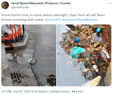
 Storm drains had to be cleared out this morning after heavy rain and thunder overnight in Regina.
Smoke clears out at 4pm in ReginaForest Fires (FireSmoke.ca)
Wednesday, August 09, 2023
Moderate Risk Day 2 Thursday, August 9th, 2023
Moderate Risk Day 2 Thursday, August 9th, 2023
Tuesday, August 01, 2023
New Playlist: Old Music New Videos
Check out our new playlist on YouTube, all the new videos with old music will be showing up here:


