Today's Song via YouTube Music
Canadian Prairie Storms Pages
Wednesday, August 30, 2023
Tuesday, August 29, 2023
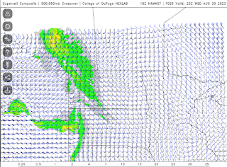
Moderate Risk #skstorm Supercells on Wednesday
The latest high resolution forecast model is showing a line of strong thunderstorms across southeast Saskatchewan between 5pm and 9pm, moving northeast from there overnight into Manitoba for Thursday's risk. Up to 2 cm hail and flash flooding are the main risks. High winds and tornado risk are very low. Supercell structure might be good. Note: tornado risk increases overnight into Thursday for Manitoba. Several waves possible.
Potential 220 km/hr Landfall for Hurricane Idalia
Check out the potential maximum wind gust via the NAM Nest for #Hurricane #Idalia from 119 knots at land fall, 80 knots well inland through Tallahassee, Florida. #FLwx
— ⚡️StormRangerBike🤠🚲 (@StormRangerBike) August 29, 2023
119 knots=220km/hr=137mph
80 knots=148km/hr=92mph
Lots of potential to damage structures at those rates. pic.twitter.com/YRuy4n6zVG
Danger Area in northern Florida Wednesday morning
Monday, August 28, 2023
Strong Thunderstorm / Weak Tornado Wednesday
Spotted a tornado in the first run of the NAM Nest 18z which shows a system developing over the city of Regina between 7pm and 9pm with 0.74 inches/1.9cm of rain, potential for a weak tornado and the supercell index climbed well above what the GFS was saying last night. Looks very localized, most of southeast Saskatchewan will get showers and lightning at most. Keep in mind the smoke could tear this whole idea apart, wildfire / forest fire smoke continues to be very bad in the far north. Add a strong full moon cycle as well into the mix and it will get interesting for sure, storm season isn't over.
Today's Song: Bad Moon Rising
Check TimeAndDate.com for moon phases and SpaceWeather.com for Solar Flares
Its Happening!
Extreme humidity mixing with smoke and drought this morning as of
— ⚡️StormRangerBike🤠🚲 (@StormRangerBike) August 28, 2023
7am 94% humidity and 10C?! at the airport.
7:40am: 71% downtown and 17C feels way hotter than that. #yqrWeather #skstorm on Windy Wednesday for sure... pic.twitter.com/mYD1czsJKA
Subscribe to:
Comments (Atom)


