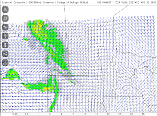
The latest high resolution forecast model is showing a line of strong thunderstorms across southeast Saskatchewan between 5pm and 9pm, moving northeast from there overnight into Manitoba for Thursday's risk. Up to 2 cm hail and flash flooding are the main risks. High winds and tornado risk are very low. Supercell structure might be good. Note: tornado risk increases overnight into Thursday for Manitoba. Several waves possible.
Today's Song via YouTube Music
Canadian Prairie Storms Pages
Tuesday, August 29, 2023
Potential 220 km/hr Landfall for Hurricane Idalia
Check out the potential maximum wind gust via the NAM Nest for #Hurricane #Idalia from 119 knots at land fall, 80 knots well inland through Tallahassee, Florida. #FLwx
— ⚡️StormRangerBike🤠🚲 (@StormRangerBike) August 29, 2023
119 knots=220km/hr=137mph
80 knots=148km/hr=92mph
Lots of potential to damage structures at those rates. pic.twitter.com/YRuy4n6zVG
Danger Area in northern Florida Wednesday morning
Subscribe to:
Comments (Atom)


