Monday, June 01, 2015

Tonight's Severe Weather Outlook Map

June 1st, 2015

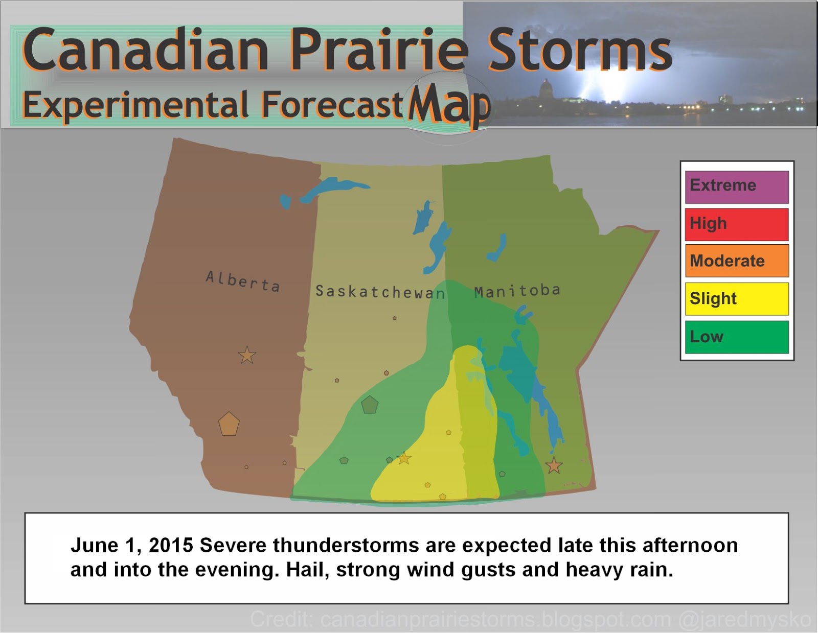
Storms will continue moving east overnight along the Manitoba/North Dakota border. Hail, strong wind gusts and heavy rain are the main risks associated with these storms. Another larger system in Montana may touch the extreme southern border of Saskatchewan late tonight. On Tuesday, storms are expected to keep south of the international border with a possible risk of strong tornadoes in the Dakotas. Much needed rain for the city of Regina has once again missed us and water rationing by residents and businesses begins to ramp up as severe drought threatens the area.


Today's Severe Weather Outlook Map

June 1, 2015

Severe thunderstorms can be expected later today in south east Saskatchewan and along the Manitoba border into the evening. Hail, strong wind gust and heavy rain will be the main threats.


Sunday, May 31, 2015

New Forecast Map: Version 2015

Here is our first map of the season with storm season right on track as we enter the month of June. Storms may persist overnight throughout areas of southern and central Saskatchewan, bringing a risk of small hail, gusty winds and heavy downpours. The risk moves east and south for the day tomorrow as this system begins to pick up steam and build toward the Dakotas, Monday and Tuesday.


*This latest version of the Experimental Forecast Map was re-built using the original format from 2012 by CorelDraw and can now be updated using the new "Fire Alpaca" software.
 (its always fun to try out new programs!)