

Play by Play Commentary on Local and International Weather Events
Documentation and Relay Alerts of Severe Weather Events from Regina, Saskatchewan.
The Source Since 2002
Wednesday, July 24, 2013
Today's Outlook Map - Pattern Continues Along Foothills
This pattern of small but strong storms along the southern Alberta foothills continues today, venturing a bit further south east towards the US border. The same scenario tomorrow but further north west into the central Alberta foothills, then it begins to move off on Friday into western Saskatchewan.

Tuesday, July 23, 2013
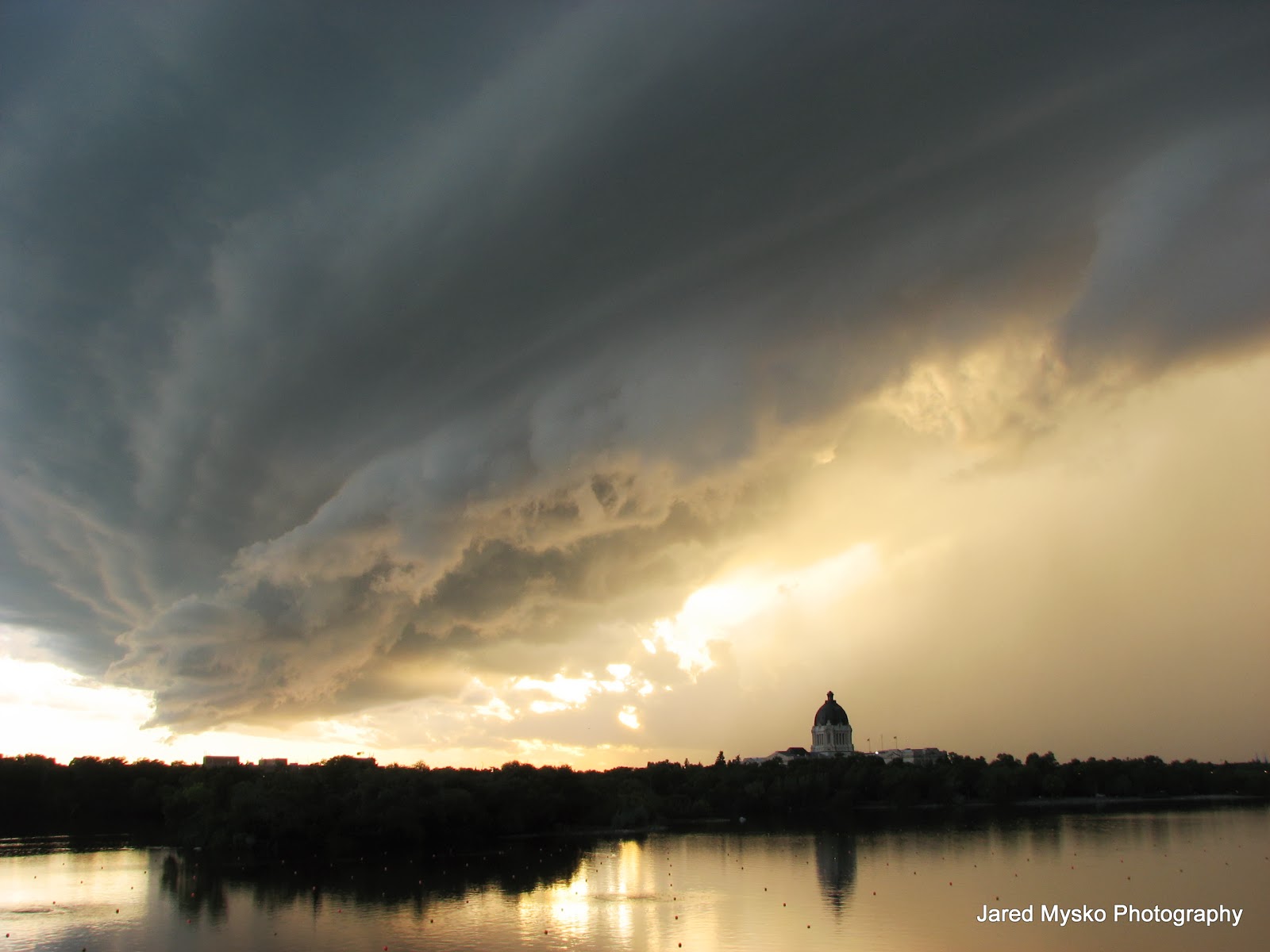
Super Structure Storm Surprises
UPDATE: Added the full version video of the storm hitting and camera smashing to the ground:
This is the final set of photos taken by the Canon S3 as it took a tumble on the concrete pavement as the gust front flipped over the tripod. I was also trying to shoot with my BlackBerry Playbook at the time and caught video of the whole thing. This camera has done some amazing work and has been through it all. I am amazed it has lasted this long. Sadly the video footage it was taking can not be recovered but the camera can be replaced.


This is the final set of photos taken by the Canon S3 as it took a tumble on the concrete pavement as the gust front flipped over the tripod. I was also trying to shoot with my BlackBerry Playbook at the time and caught video of the whole thing. This camera has done some amazing work and has been through it all. I am amazed it has lasted this long. Sadly the video footage it was taking can not be recovered but the camera can be replaced.


More video clips:
Brief Storm Possible To Graze Regina By Sundown
A heavy rain and intense lightning storm hit the city of Saskatoon a few hours ago and is slowly moving towards Regina at this time. If it hold together it may just catch the north end, spread out or nothing at all. Currently this small but powerful cell looks like a mini gust front with high tops, suggesting it will keep its strength by sundown near Regina where it should quickly dissipate.
Here is a look at the echo tops screen grab:

And today's outlook map:

Here is a look at the echo tops screen grab:

And today's outlook map:

Subscribe to:
Posts (Atom)